
01
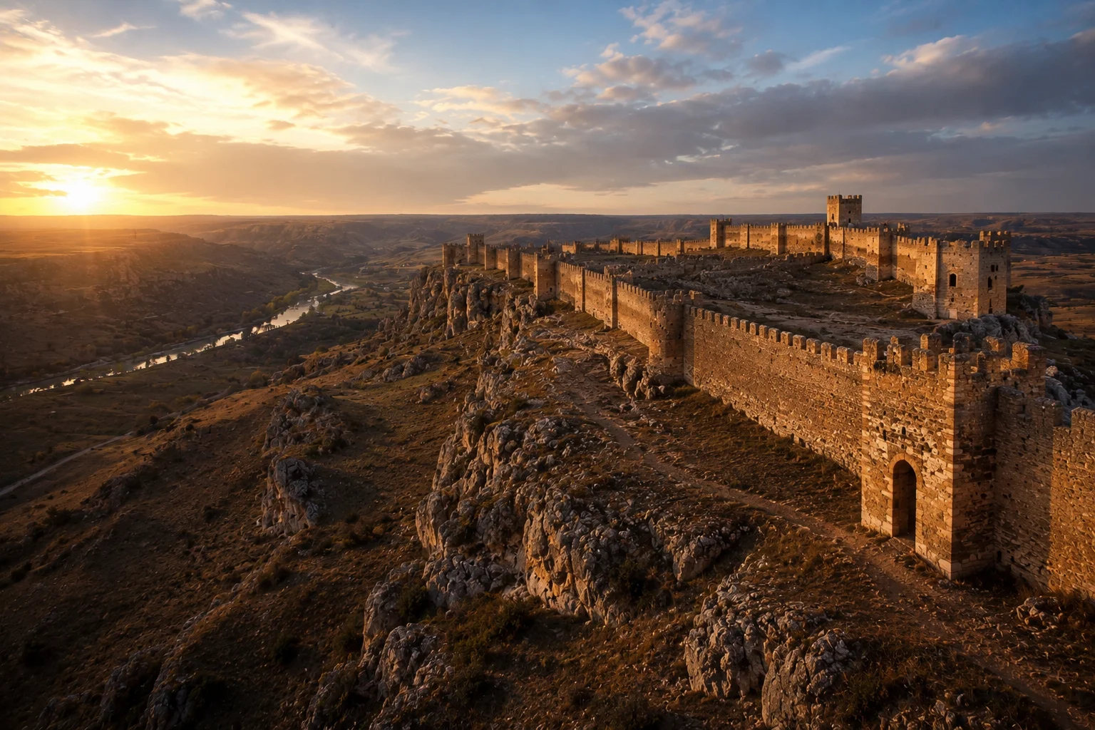
Lords Of The Duero
On Your Way You Will Encounter
Gormaz Fortress
The Great Fortress Of The Route
- Largest Islamic fortress in Europe.
- El Cid governed here.
- One of the most important sites on the route.
Featured Ride - Expedition Collection
From Exile To Conquest
A chapter-based mountain bike expedition across medieval Spain, following Rodrigo Diaz de Vivar from Castile to castles, canyons, frontier kingdoms and the Mediterranean Sea.
1,180 km
GPX line to Valencia
Real GPX
route geometry
9 chapters
expedition
20+ castles
historic line
4 regions
historic Spain
Mediterranean
finish
Meet The Legend
Before there was a route, there was a man. Rodrigo Diaz de Vivar was born near Burgos around 1043, during one of the most turbulent periods in Iberian history. Spain did not yet exist. Christian kingdoms and Muslim taifas fought constantly for power.
Rodrigo became a warrior, commander, diplomat and leader. In 1081 he lost the favour of King Alfonso VI, was banished from Castile, stripped of land and title, and forced to leave everything behind.
Many men would have disappeared. Instead, Rodrigo began a journey. His campaigns became stories. The stories became songs. The songs became the Cantar de Mio Cid, one of the great works of medieval Europe.
1043
Rodrigo Diaz de Vivar is born near Burgos.
1081
Exiled from Castile after losing the favour of Alfonso VI.
1088-1093
Campaign years across frontier kingdoms and contested territories.
1094
Conquest of Valencia.
1099
Death in Valencia.
Today
Ride the legend from Castile to the sea.
Chapter Map
The Camino del Cid line is shown as a chapter route on real terrain map tiles. Click through the agenda to see how the journey moves from Castile into the Duero frontier, Alto Tajo, Albarracin, the inland passes and the final ride to Valencia.
Interactive chapter map
Click a chapter to isolate the route section on a real terrain map.
Route logic
A chapter view of the El Cid line from Vivar and Burgos through the Duero frontier, Alto Tajo, Albarracin and Valencia.
Heritage On The Way
This expedition is not only distance and climbing. On your way you encounter the fortress line that gives the Camino del Cid its weight: Islamic strongholds, hilltop castles, frontier watchpoints and medieval towns that turn the ride into a moving history lesson.
01
Lords Of The Duero
On Your Way You Will Encounter
The Great Fortress Of The Route
02
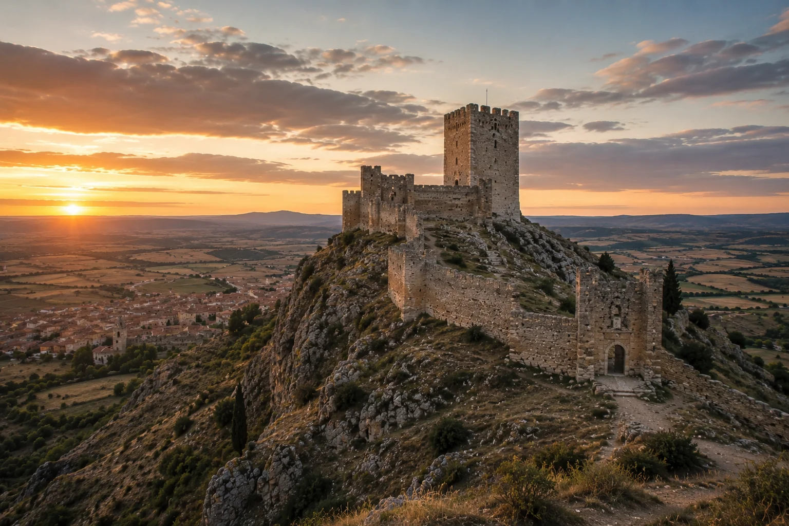
The Frontier Chapter
On Your Way You Will Encounter
A Hilltop Castle Built For Drama
03
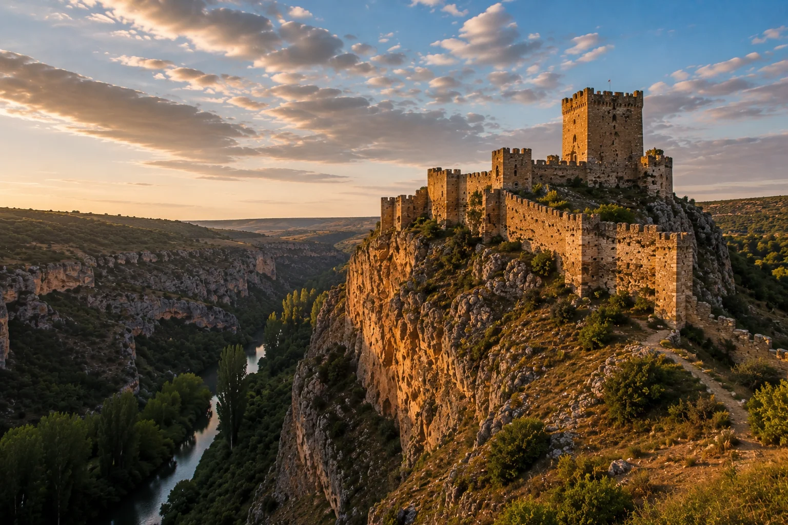
The Rio Dulce Vision
On Your Way You Will Encounter
The Expedition's Visual Hero
04
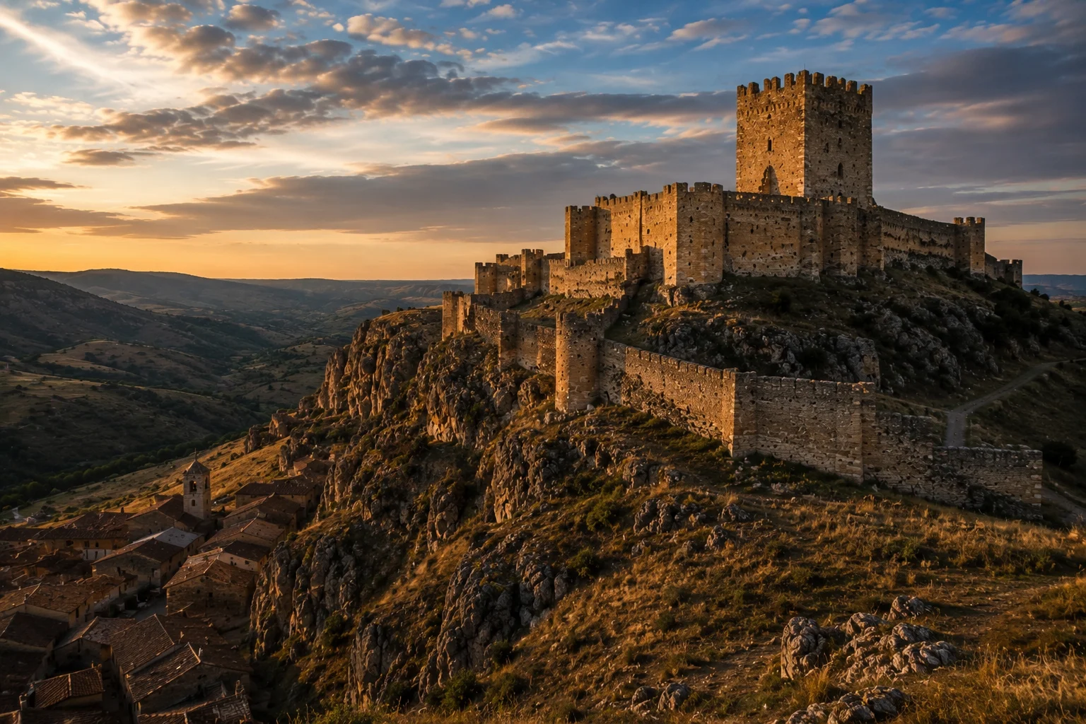
The Red Fortress
On Your Way You Will Encounter
The Great Arrival
Narrative anchor
El Castillo del Cid
05
The Borderlands
On Your Way You Will Encounter
The Name Says Everything
The Journey
The expedition is built as a chapter ride: The Exile, The Borderlands, The Three Taifas and The Conquest. Each chapter changes the riding surface, landscape and historical mood.
I
CHAPTER I
Vivar del Cid → Santo Domingo de Silos
Distance
70 km
Elevation Gain
1,200 m
Ride Time
5–7 hrs
Terrain
Gravel roads, rural tracks, rolling hills
Every great story begins with a departure. For El Cid it was exile. For riders, it is the moment the expedition leaves Vivar, crosses Burgos and enters the emotional heart of the route around San Pedro de Cardena and Silos.
San Pedro de Cardena is the emotional centre of the exile story. Santo Domingo de Silos anchors the day in one of medieval Spain's great religious landscapes.
II
CHAPTER II
Santo Domingo de Silos → Langa de Duero
Distance
65 km
Elevation Gain
1,100 m
Ride Time
5–6 hrs
Terrain
Forest roads, gravel climbs, ancient tracks
Civilisation thins and the frontier begins. The route moves through La Yecla, ancient juniper forests and quiet ridges where the geography starts to feel older than the kingdoms that fought across it.
The forests formed a natural barrier between Christian and Muslim territories. The castles followed the shape of the land.
III
CHAPTER III
Langa de Duero → El Burgo de Osma
Distance
70 km
Elevation Gain
900 m
Ride Time
6–7 hrs
Terrain
Fast gravel, river valleys, vineyard tracks
The Duero was once a frontier corridor and a battleground. Here the route feels open and visible, with vineyards, river valleys and fortified ridges turning history into landscape.
Gormaz Fortress dominates the route. It is one of the great Islamic fortresses of Europe and a place linked to El Cid's governorship.
IV
CHAPTER IV
Atienza → Siguenza
Distance
55 km
Elevation Gain
900 m
Ride Time
5–6 hrs
Terrain
Canyon tracks, limestone trails, oak forest
Atienza stands like a warning on the edge of Castile. From there the line drops into the Rio Dulce landscape, where castles, cliffs and eagles give the route one of its most cinematic days.
Atienza protected Castile. Pelegrina controlled the canyon. The terrain itself became a defensive system.
V
CHAPTER V
Siguenza → Alto Tajo
Distance
65 km
Elevation Gain
1,100 m
Ride Time
6–7 hrs
Terrain
Remote forest roads, deep canyons, wild river country
This is where the expedition starts to feel truly remote. The route leaves the obvious towns and enters the wild interior: deep canyons, forested ridges and river country where medieval travel was never casual.
In medieval times, travelling through this country meant risk. Nature formed the frontier as much as politics did.
VI
CHAPTER VI
Alto Tajo → Albarracin
Distance
55 km
Elevation Gain
1,000 m
Ride Time
6–7 hrs
Terrain
Mountain forest, red sandstone, technical ridges
Albarracin is one of the great arrivals in Spain: red walls, narrow streets and fortress lines rising from the landscape. After the isolation of Alto Tajo, the town feels like a reward.
Albarracin was once an independent taifa kingdom and one of the great strongholds of medieval Aragon.
VII
CHAPTER VII
Albarracin → Gallocanta → Daroca
Distance
60 km
Elevation Gain
900 m
Ride Time
5–6 hrs
Terrain
Open plains, wetland tracks, big-sky gravel
The route opens into scale: huge skies, migration routes, wetlands and the medieval trade line toward Daroca. It is a psychological shift from mountain fortress to open horizon.
Gallocanta predates kingdoms as a landscape. Daroca later controlled one of Aragon's great trade routes.
VIII
CHAPTER VIII
Puebla de Arenoso → Montanejos → Navajas
Distance
60 km
Elevation Gain
1,500 m
Ride Time
7–8 hrs
Terrain
Limestone canyons, river valleys, Mediterranean forest
This is the stage riders remember. The expedition dives into the Mijares and Palancia mountain country, with Montanejos, La Maimona and Mediterranean forest creating the biggest riding day of the journey.
These mountains protected access to Valencia. Control of the passes meant control of the east.
IX
CHAPTER IX
Navajas → Valencia
Distance
75 km
Elevation Gain
400 m
Ride Time
6–7 hrs
Terrain
Greenway rhythm, orange groves, Mediterranean plains
The last day releases the mountains. The air warms, the land flattens and Valencia appears as the destination that changed Rodrigo from exile into legend.
Valencia was El Cid's greatest achievement. It is the city that completes the transformation from banished knight to legend.
Official Guide Material
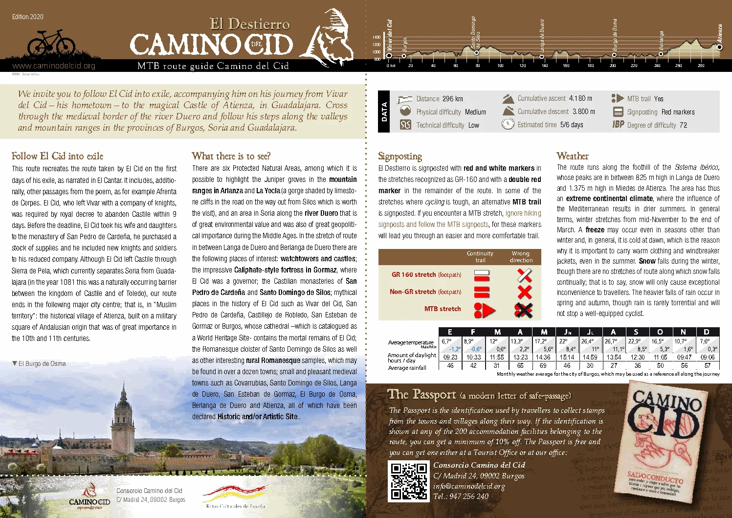
The uploaded Camino del Cid MTB route guides are not background research. They become the expedition dossier: maps, profiles, town sections, route data, signposting and weather logic translated into a rideable Epic Bike Trails format.
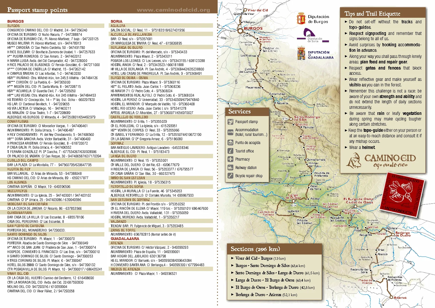
The Exile Route
296 km
4,180 m
5/6 days
Vivar del Cid, Burgos, Santo Domingo de Silos, Langa de Duero, El Burgo de Osma, Berlanga de Duero and Atienza.
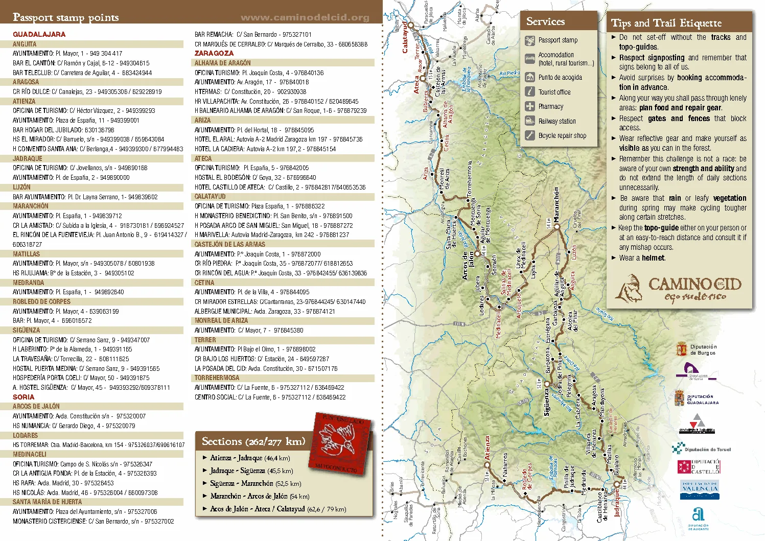
The Borderlands Route
277 km
3,160 m
5 days
Atienza, Jadraque, Siguenza, Maranchon, Arcos de Jalon, Ateca and Calatayud through the old Muslim borderlands.
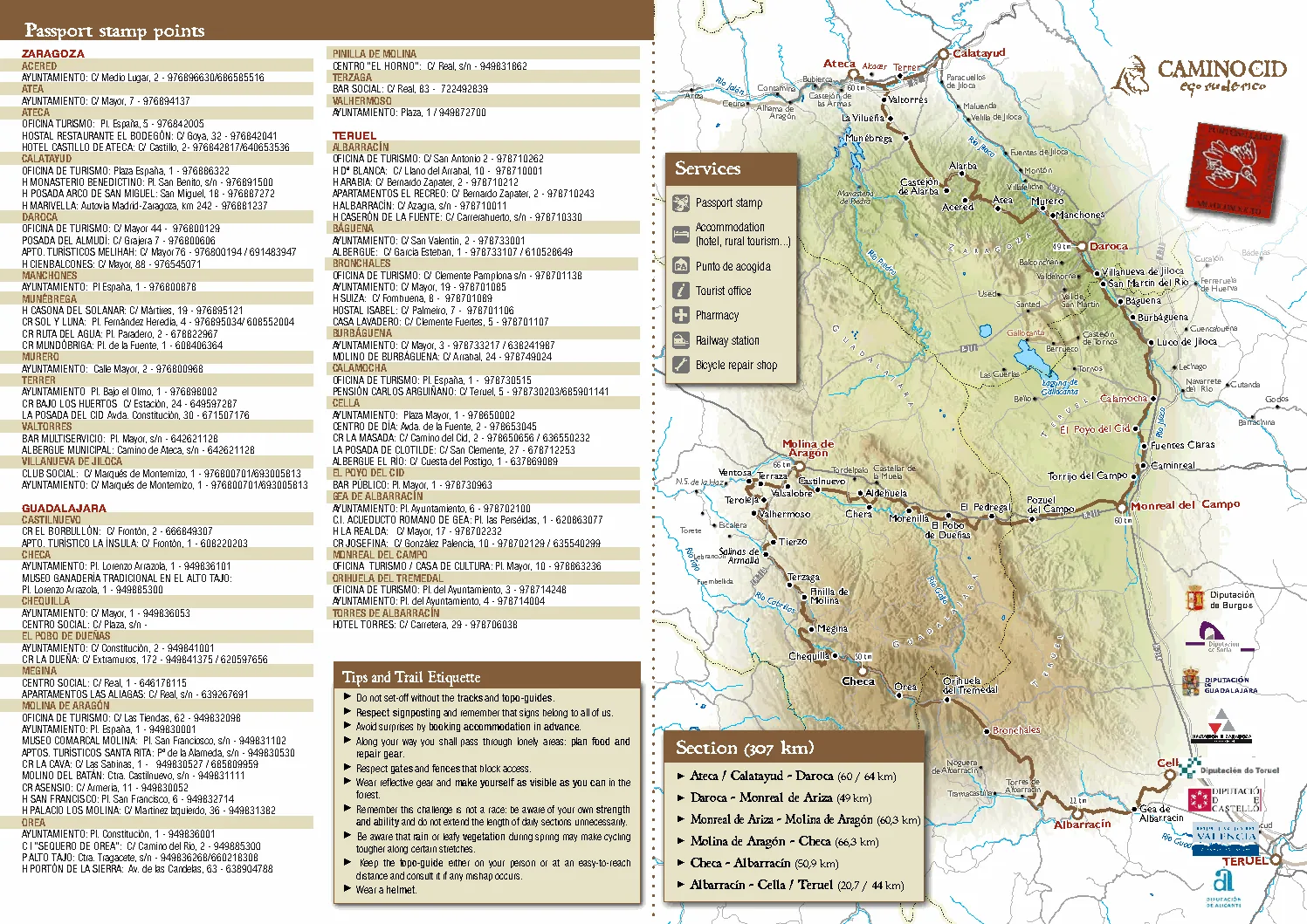
The Three Taifas Route
307 km
4,550 m
6 days
Ateca or Calatayud to Daroca, Molina de Aragon, Checa, Albarracin and Cella or Teruel through taifa landscapes.
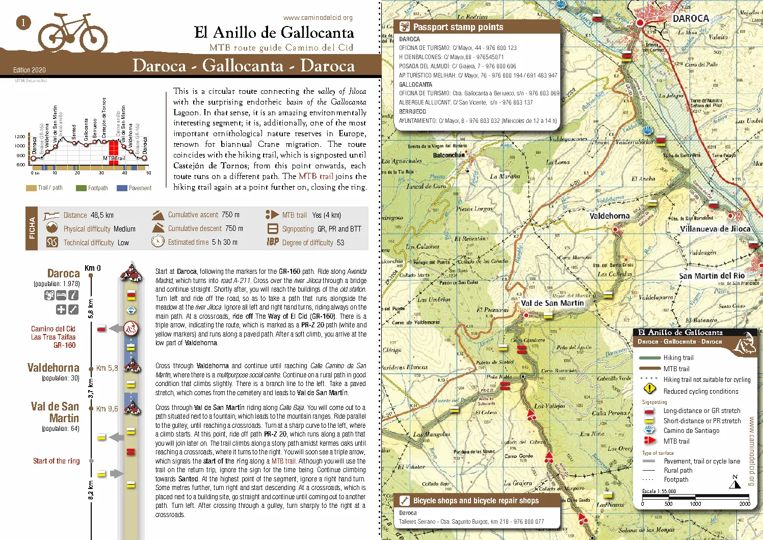
Gallocanta Circular Route
48.5 km
750 m
5 h 30 m
A circular field-guide route from Daroca around Gallocanta, adding wetland scale and big-sky riding to the expedition.
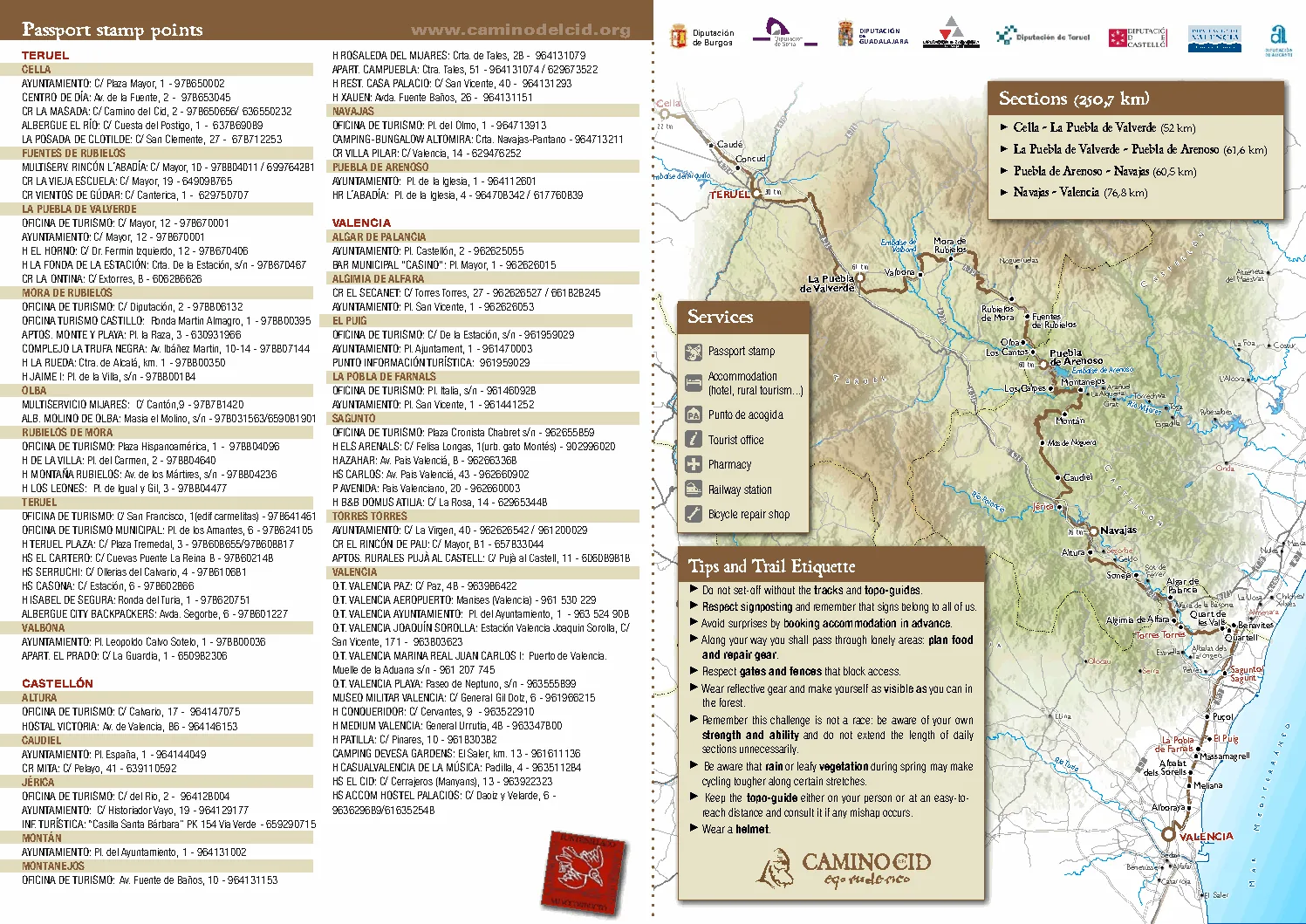
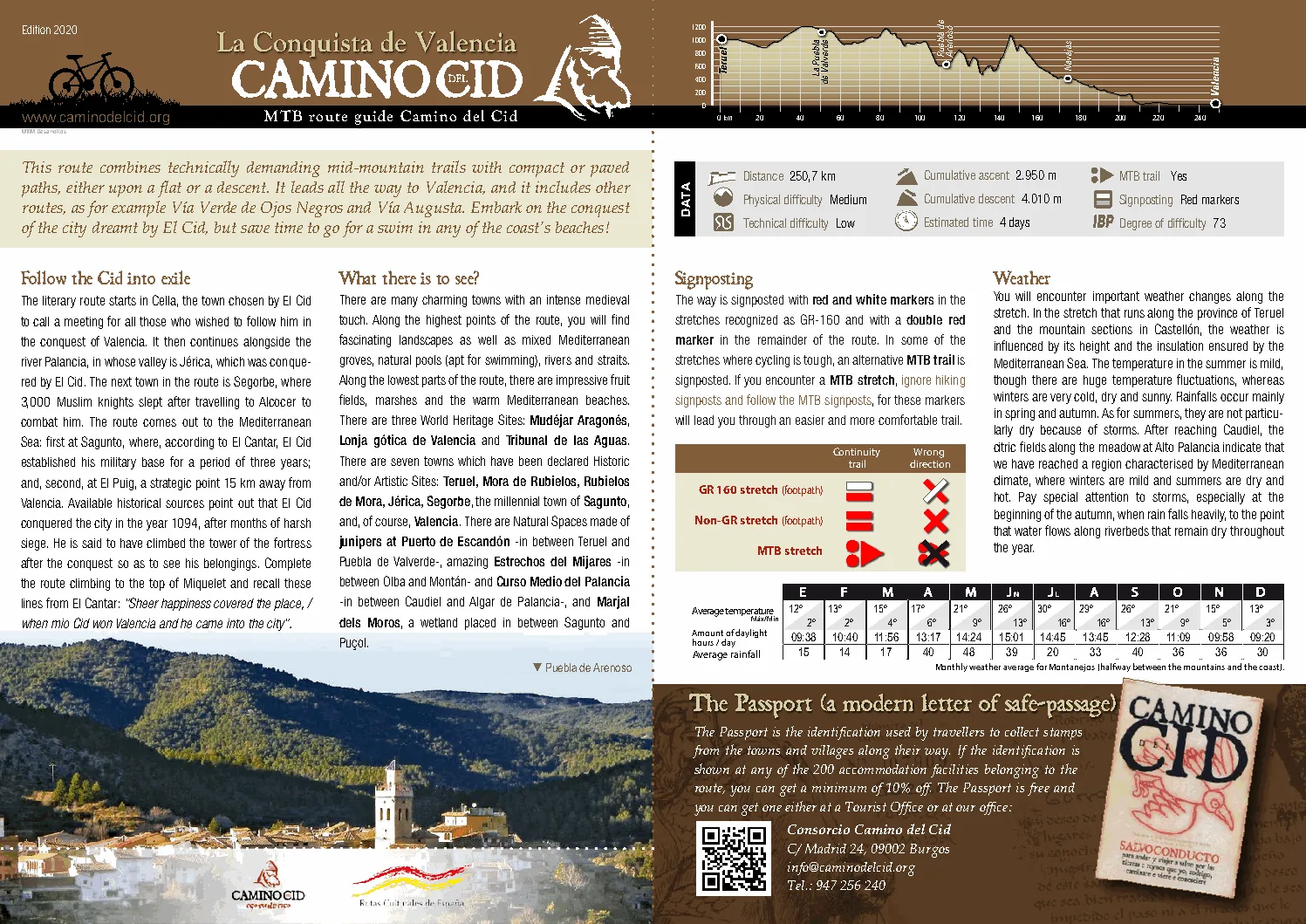
The Conquest of Valencia Route
250.7 km
2,950 m
4 days
Cella, La Puebla de Valverde, Puebla de Arenoso, Navajas and Valencia, with Montanejos and the Mediterranean finish.
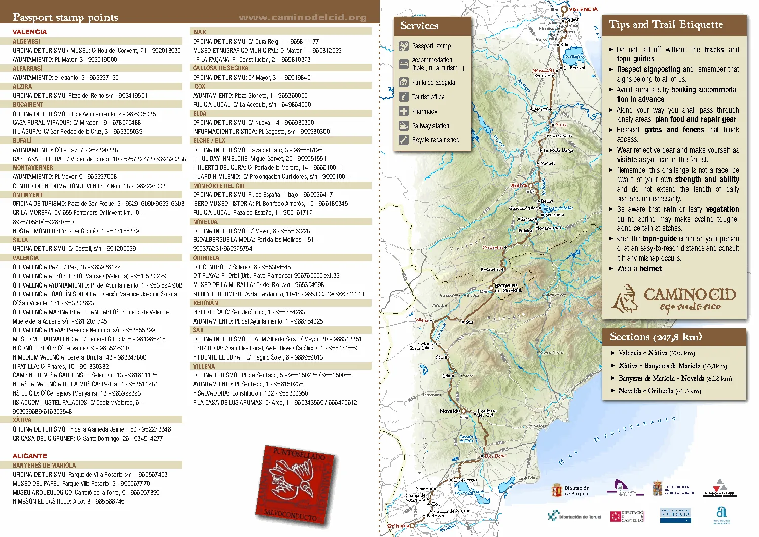
Defending The South
247.8 km
1,730 m
4 days
Valencia, Xativa, Banyeres de Mariola, Novelda and Orihuela: a southern extension for riders who want more Camino del Cid.
Maps And Profiles
These guide plates preserve the expedition feeling: profile, services, signs, weather and cartography together. They make the ride feel like a campaign, not a product card.
Field plate 01
The guide plates bring the expedition into the page: elevation profile, official section logic, weather notes, signposting, services and map line in one visual field.
Field plate 02
The borderland maps show how the route is not an abstract line. It is a sequence of towns, rivers, castles and service points across rural Spain.
Field plate 03
The Conquest of Valencia guide material supplies the final campaign geography: Teruel, Montanejos, Navajas, Sagunto, El Puig and the city.

Epic Take
The Camino del Cid is not a route to be completed. It is a story to be lived.
Across mountains and kingdoms, through wilderness and history, every kilometre brings the rider closer not only to Valencia, but to the spirit of adventure itself. Ride the legend. Write your own chapter.
Featured Ride